Maps
A lot of information on the the Reykjanes Peninsula can be found at http://www.visitreykjanes.is/en
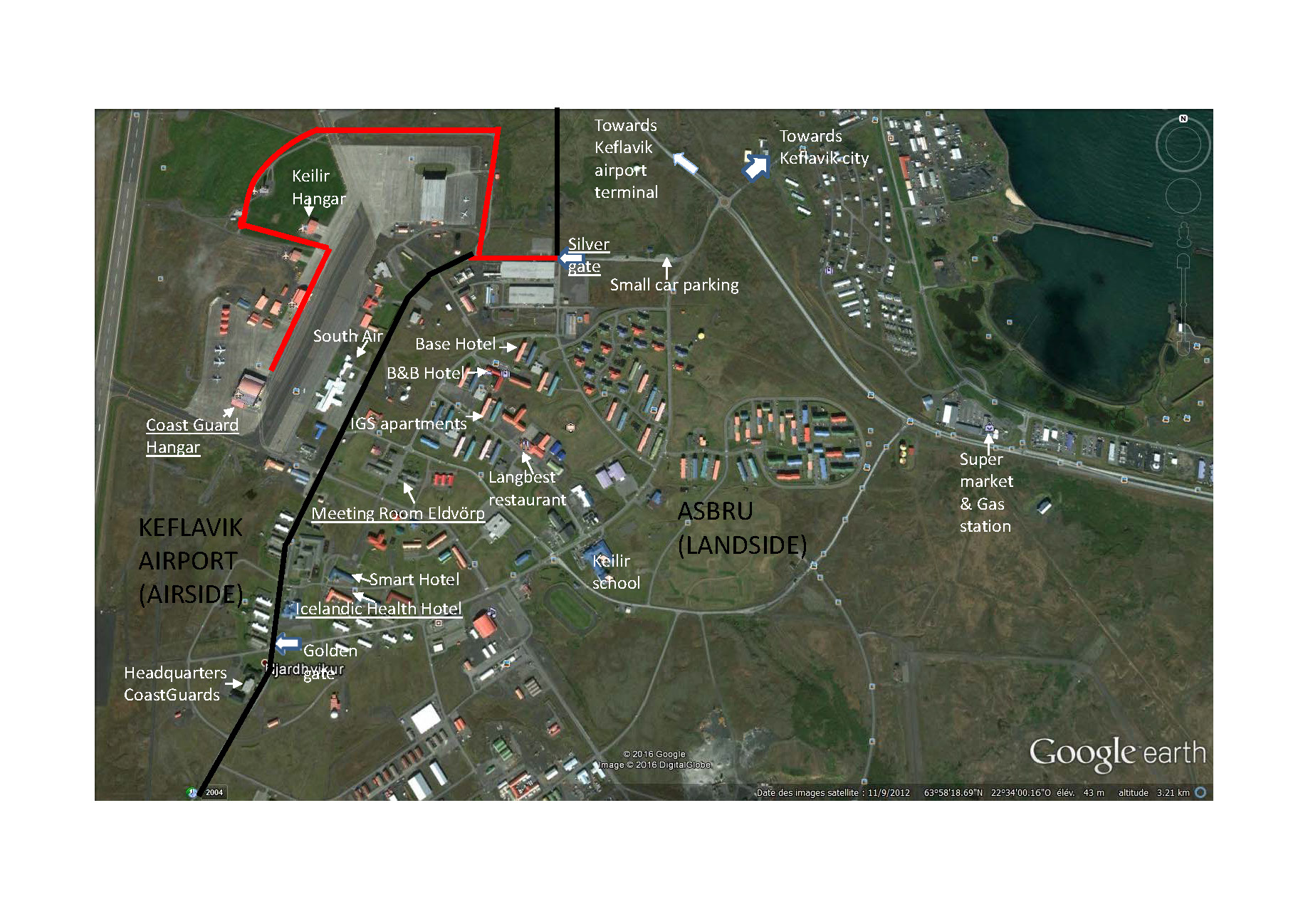
Map of the Keflavik Airport Area

Map of the Keflavik Airport Area
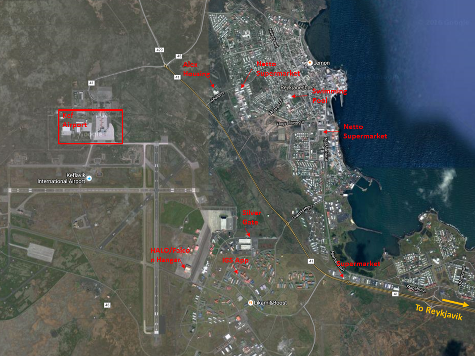
Map of the "greater area" of Keflavik
Map of souteastern part of Iceland with the Reykjanesbær peninsula

Map "Places to see"
